
Location: Jung-gu & Yongsan-gu, Seoul | Category: Observation Tower, Urban Park, Hiking | Best For: First-time visitors, Couples, Photography enthusiasts
A 236-meter communication tower crowns the peak of Namsan Mountain, 480 meters above sea level. Since opening to the public in 1980, N Seoul Tower has drawn approximately 8.4 million visitors annually (Wikipedia). In 2012, foreign tourists ranked it Seoul's number one attraction in a Seoul Metropolitan Government survey.
This guide breaks down everything: the tower observatory, the surrounding trails, practical logistics, and the less-crowded alternatives most visitors miss.

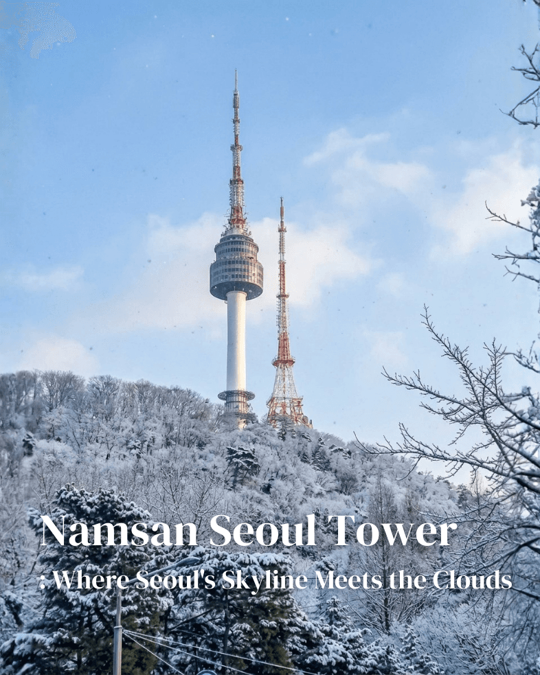
Snow blankets Namsan's pine forests while the tower rises into a pale winter sky—Seoul's clearest visibility often comes on cold, dry days
At a Glance
| Address | 105, Namsangongwon-gil, Yongsan-gu, Seoul (서울 용산구 남산공원길 105) |
| Observatory Hours | Mon–Thu 12:00–22:00 / Fri–Sun & Holidays 11:00–22:30 |
| Last Entry | 30 minutes before closing |
| Observatory Admission | KRW 21,000–26,000 (~USD 15–19) / Online discounts available |
| Cable Car | KRW 15,000 adults / KRW 11,500 children (round-trip) |
| Time Needed | 2–4 hours (tower only) / 4–6 hours (tower + trails) |
| Best Time | 1 hour before sunset for day-to-night transition |
| Namsan Park | 24 hours, Free |
Why N Seoul Tower Still Matters
Built in 1971 as South Korea's first integrated broadcast transmission tower, the structure originally served KBS, MBC, and SBS television signals. The observatory opened in 1980 after security concerns were resolved—the presidential Blue House had been visible from the top.
What keeps the tower relevant decades later: unobstructed 360-degree views of the entire Seoul metropolitan area, the Han River winding through the city, and on clear days, even North Korea's Songaksan Mountain in the distance.
The "Locks of Love" terrace on the second floor has become a cultural phenomenon. A 2011 Seoul Metropolitan Government poll found 16% of foreign visitors named locking a padlock here as their favorite activity in Seoul. K-drama filming locations—Boys Over Flowers, My Love from the Star, Itaewon Class—continue to draw fans.

The three-minute cable car ride passes through dense forest—fall colors peak from late October
The Five Trails of Namsan Dulle-gil
Most visitors ride the cable car or bus directly to the tower. They miss the 7.5km trail network that wraps around Namsan Mountain—completed in 2015 and connecting 14 subway station access points.

The complete Namsan Dulle-gil network spans five color-coded themed routes
Trail Overview
| Trail | Distance | Character |
| North Ringway (북측순환로) | 3,420m | Flat, paved, pedestrian-only. Most popular section connecting major landmarks |
| Forest Path (산림욕길) | 910m | Dirt path through pine forests. Connects to archery club Seokhojeong |
| Wildflower Path (야생화길) | 880m | Eight wildflower gardens and children's forest playground |
| Natural Ecology Path (자연생태길) | 1,650m | Cherry trees, pine forest, connects to South Ringway |
| History & Culture Path (역사문화길) | 640m | Passes Ahn Jung-geun Memorial, Namsan Public Library, historical sites |

Official trail guide showing detailed paths, rest areas, and points of interest
Which Route to Take
Short on time (1–1.5 hours): North Ringway only. Start from Hoehyeon Station Exit 4, walk to Baekbeom Square, and follow the flat paved path. No vehicle or bicycle traffic.
Half-day exploration (3–4 hours): Combine the History & Culture Path with North Ringway. Start from Seoul Station, walk via Seoullo 7017 overpass, pass historical monuments, then loop toward the cable car or tower entrance.
Full hiking experience (4–6 hours): Connect all five trails for the complete loop. The elevation gain is modest—about 300 meters total—but the continuous inclines add up.
The North Ringway closes to motorized traffic year-round, making it one of Seoul's quietest urban walks.
What to See at the Tower

Looking down from the tower: the cable car station, autumn hillside, and sections of the restored Seoul City Wall
Outdoor Plaza (Free Access)
The area surrounding the tower base requires no ticket. Here you'll find:
Palgakjeong Pavilion — An octagonal structure at the site of the former Guksadang Shrine. Traditional martial arts demonstrations occur here daily at 15:00.
Mongmyeoksan Beacon Mound — Where signal fires were lit during the Joseon Dynasty to relay military information across the peninsula.
Love Lock Terrace — Thousands of padlocks cover the fences surrounding the tower base. Locks and markers are sold at nearby vendors (KRW 5,000–15,000).

Sunset behind the lock-covered fences—the most photographed angle on the mountain

Messages from visitors worldwide: dates, names, wishes written in every language
Observatory Deck (Paid)
The observation floors occupy the 3rd through 5th levels of the tower, accessible via a 30-second elevator ride.

Visitors on the wooden deck look north toward Bugaksan Mountain and the city below
Digital Observatory (3F) — "Inside Seoul" media art installation using mixed reality technology. LCD screens display Seoul's four seasons, historical timelines, and future projections.
Main Observation Deck (4F–5F) — Floor-to-ceiling windows with distance markers showing how far you are from major world cities.

Wellington: 9,943km. Busan: 291km. A red mailbox lets visitors send postcards dated from the tower

Paris, Rome, Moscow, Beijing—markers point toward each city's actual direction
The revolving restaurant N.Grill occupies the top floor, completing one rotation every 48 minutes. Dining reservations include complimentary observatory access.
Ahn Jung-geun Memorial Hall
Located along the History & Culture Path, this museum honors the independence activist who assassinated Japanese Resident-General Itō Hirobumi in 1909. The 2010 reconstruction features 12 glass-walled buildings symbolizing Ahn's "Finger Allegiance" pledge.

The modernist glass structure glows against Namsan's hillside after dark
| Hours | Mar–Oct: 10:00–18:00 / Nov–Feb: 10:00–17:00 |
| Admission | Free |
| Closed | Mondays, Seollal & Chuseok holidays |
| Time Needed | 30–60 minutes |
The exhibition covers Ahn's life from birth to execution through photographs, personal belongings, and calligraphy he wrote while imprisoned. English audio guides are available.
Getting There
To the Cable Car Station
Subway: Myeongdong Station (Line 4) Exit 3 → 10-minute uphill walk past Pacific Hotel and along Cartoon Street
Alternative: Hoehyeon Station (Line 4) Exit 4 → 5-minute walk to Baekbeom Square → follow signs to cable car
To the Tower (Bypassing Cable Car)
Namsan Circular Bus 01/02: Board at Chungmuro Station (Line 3/4) Exit 2 or Dongguk University Station (Line 3) Exit 6 → Direct to N Seoul Tower stop (15–20 minutes)
On foot: From Hoehyeon Station Exit 4, the hiking trail to the summit takes 40–60 minutes depending on pace and route
For Taxis
Show this address: 남산서울타워 or 105 남산공원길 용산구
Note: Private vehicles cannot enter Namsan since 2005 for environmental protection. Taxis drop passengers at the cable car base or designated parking areas.
Timing Your Visit
Crowd Patterns
| Time | Crowd Level | Notes |
| Weekday mornings | Low | Observatory opens at 12:00 (Mon–Thu), trails accessible 24 hours |
| Weekday late afternoon | Moderate | Builds toward sunset |
| Weekend sunset hours | High | Expect 20–30 minute waits for elevator |
| Weekend after 20:00 | Moderate | Crowds thin after dark |
| Holidays | Very high | Golden Week, Chuseok, Christmas Eve are peak |
Seasonal Considerations
Spring (April): Cherry blossoms line the Natural Ecology Path and South Ringway. Pink tunnel effect near the intersection.
Summer (July–August): Hot and humid. Morning or evening visits recommended. The forested trails remain cooler than the open plaza.
Autumn (October–November): Peak foliage season. The cable car ride becomes a five-minute window into red, orange, and yellow canopy.
Winter (December–February): Clear, dry days offer the longest visibility—sometimes past 50km. Night illumination runs until 23:00 (22:00 in winter) when air quality is good (PM2.5 under 45).
Practical Tips
Buy tickets online. Observatory admission at the on-site counter costs KRW 26,000 for adults versus KRW 16,000–21,000 through Klook, KKday, Creatrip, or Trazy. Same-day booking works.
Combine cable car and hiking. Ride up, walk down (or vice versa). The descent through the forest takes 30–40 minutes and passes historical markers invisible from the road.
Bring layers. The summit is 5–8°C cooler than Myeongdong below. Wind on the outdoor terrace amplifies the chill.
Visit the mailbox. The red "POST" box inside the observatory accepts postcards that receive a special N Seoul Tower stamp. Postcards available at the gift shop.
Skip the elevator line. N.Grill or Hancook restaurant reservations include observatory access. Dinner prices start around KRW 80,000 per person.
Use the Namsan Trail map. Grab a paper copy from any Seoul Tourist Information center (available at most major subway stations). The marked trails are easier to follow with the official route overlay.
Is It Worth It?
For KRW 15,000–21,000 (observatory) or KRW 30,000–36,000 (observatory + cable car), you get Seoul's most recognizable vantage point, a functioning piece of broadcast history, and easy access to one of the city's best urban trail networks.
Go if: You want the classic Seoul skyline photo, you're interested in K-drama filming locations, or you prefer structured observation decks over hiking to viewpoints.
Skip if: You're saving budget for Lotte World Tower Seoul Sky (higher but pricier), you dislike crowds, or you prefer earning your views via mountain trails.
Namsan works as both a quick two-hour stopover and a full-day exploration depending on how deep you go. Most visitors stay at the surface. The trails and historical sites reward those who look further.
📌 Quick Reference
- Official site: www.nseoultower.co.kr
- Real-time updates: @nseoultower (Instagram)
- Info hotline: ☎ +82-2-3455-9277 (Korean, English)
- Namsan Cable Car: www.cablecar.co.kr
- Location: 105 Namsangongwon-gil, Yongsan-gu, Seoul (서울 용산구 남산공원길 105)
- Nearby: Myeongdong (10 min), Namsangol Hanok Village (15 min), Itaewon (20 min)